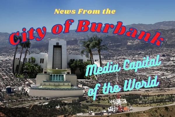
Burbank’s City Council will be holding a public hearing on November 10 to discuss the Media District Specific Plan.


Municipal planners in Burbank have released a comprehensive update to the Media District Specific Plan, establishing a long-range blueprint to guide growth across the city’s 544-acre media and commercial core. Modernizing a planning framework originally enacted in 1991, the updated proposal sets forward-looking guidelines for multi-family residential construction, technical traffic forecasting, and sweeping parking reforms designed to carry the district through 2035.
While the original 1991 plan focused primarily on protecting surrounding single-family residential neighborhoods from commercial expansion, the updated plan aligns with the Burbank2035 General Plan to balance economic growth with multi-modal transportation, expanded housing options, and enhanced public transit access.
Economic Footprint, Studio Expansion, and Fiscal Impact
The Media District represents one of Southern California’s premier employment centers, serving as the corporate home to major entertainment industry anchors including The Walt Disney Company, Warner Bros. Discovery, and Burbank Studios. Real estate analysis shows that entertainment production facilities remain the primary economic driver of the area. The buildout program anticipates approximately 350,000 square feet of new studio space, led by major planned investments at the former Warner Bros. Ranch site featuring 16 sound stages and a 320,000-square-foot office complex.
To support the growing regional workforce, municipal plans prioritize high-density housing within the district. Real estate market analyses highlight strong financial performance in Burbank’s multi-family housing sector, with average rents reaching $2.96 per square foot and lower vacancy rates than surrounding submarkets. Fiscal modeling indicates that residential growth provides direct municipal benefits, with every 100 new multi-family units estimated to generate approximately $119,900 in net positive revenue for the city’s General Fund.



Updated Traffic Counts and Modeling Methodology
To accurately evaluate future roadway conditions, transportation consultants conducted a revised traffic analysis using post-pandemic data. Baseline traffic volumes were recalculated using fresh intersection counts collected in November 2023 and September/October 2024, replacing older pre-pandemic figures. Analysts also applied a standardized minimum heavy-vehicle factor of 2 percent across all study locations.
Future traffic projections for the 2035 horizon year were developed using Burbank’s travel demand model. Planners evaluated growth between 2019 and 2035 baseline models and applied a 0.75 scaling factor to adjust 16 years of modeled growth into 12 years of projected growth added directly to the updated baseline counts. Peak-hour turning movement volumes were calculated using the matrix-based TurnsW32 software tool in accordance with National Cooperative Highway Research Program Report 765 standards.
Intersection Performance and Roadway Reconfigurations
Traffic operations were evaluated under Highway Capacity Manual 6th Edition methodology using Synchro software, grading intersection delays from free-flowing Level of Service A to severely congested Level of Service F.
The technical findings indicate that the vast majority of study intersections currently function at acceptable levels of service, designated as LOS D or better during morning and afternoon commute hours. However, key operational bottlenecks were identified. The unsignalized intersection at Clybourn Avenue and Verdugo Avenue operates at LOS E during the afternoon peak hour, while Clybourn Avenue and Riverside Drive falls to LOS F. The signalized intersection at Barham Boulevard and Forest Lawn Drive operates at LOS E during both morning and evening peak hours.
To transform the district into a safer, human-oriented environment, the plan proposes reallocating vehicular roadway capacity toward active transportation:
- Olive Avenue: Reduced from 3 travel lanes to 2 in each direction between the city boundary and Alameda Avenue.
- Pass Avenue: Reduced from 2 travel lanes to 1 in each direction between Olive Avenue and Verdugo Avenue.
- Riverside Drive: Reduced from 2 travel lanes to 1 in each direction, accompanied by a 5 mph speed limit reduction.
Rather than pursuing traditional road-widening projects to relieve localized congestion, the city is shifting toward Vehicle Miles Traveled reduction strategies and screening out legacy studio master plan vehicular mitigation mandates.
State Mandates Drive Parking Elimination and Policy Reforms
A cornerstone of the updated plan is a complete modernization of parking rules, heavily influenced by recent California legislative enactments. Under Assembly Bill 2097, public agencies are prohibited from imposing minimum parking requirements on developments located within a half-mile radius of a major transit stop.
In Burbank, this half-mile exemption zone encompasses a large majority of the Media District due to two proposed Bus Rapid Transit stops included in the regional transportation plan. Unless the city makes formal written findings demonstrating direct harm to housing goals or adjacent parking supply, developers within these transit zones are free to set their own parking ratios.
Several additional state statutes reinforce this shift:
- Senate Bill 290: Caps maximum allowable parking ratios at 0.5 spaces per residential unit for affordable housing density bonus projects near transit.
- Assembly Bill 894: Directs local jurisdictions to approve shared parking agreements when an underused facility maintains at least 20 percent unoccupied capacity, increasing effective parking supply without building new structures.
- Assembly Bill 1317: Mandates that residential rental properties with 16 or more units unbundle parking costs from housing rent starting January 1, 2025.
To align local regulations with state law, Burbank is updating Municipal Code 10-1-624 to formally mandate unbundled parking for multi-family rental developments. Policy guidelines also recommend expanding residential permit parking districts to protect neighboring residential streets from overflow commuter parking. Together, these measures support the city’s Climate Action and Greenhouse Gas Reduction Plan, which targets a reduction of 7,334 metric tons of carbon dioxide equivalent by 2045.